A blog highlighting undergraduate research in the LeRoy Lab at Evergreen

Tag: Pumice Plain (Page 2 of 2)

DNA Extractions!

Litterbag showing willow leaf litter and a unique metal tag for identification!   

Across the Pumice Plain, willow leaf litter bags are placed into streams to conduct a variety of assays. After the leaves are colonized by bacteria and fungi and begin to decompose, we remove the leaves and use DNA extractions to identify microbial communities!

Various stages in the DNA extraction process: Macerated leaf material, intermediate stages of DNA extraction, and final extracts for analysis. Photos by Lauren Thompson

The DNA extraction process entails numerous lengthy, yet exciting steps. Whether its shaking samples up vigorously with a vortexer or lysing cell matter with solutions, Evergreen Undergraduates Lauren and Maddie Thompson are always up for the challenge!

Undergraduate Maddie Thompson testing for DNA concentrations on the nanodrop! Photo by Lauren Thompson

Extracted DNA from willow samples is then sent off to characterize microbes present! This identifies what microbes colonize first, starts decomposition, provides nutrients to aquatic macroinvertebrates, and may be influenced by the sex of willows!

Organic Matter Processing – Canvas Strips!

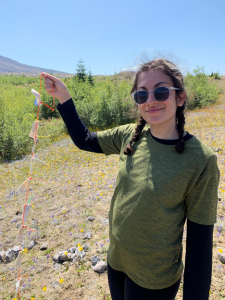
Evergreen undergraduate Maya Nabipoor getting ready to install canvas strips in Geo-West Creek on the Pumice Plain of Mount St. Helens. Photo by Carri LeRoy 

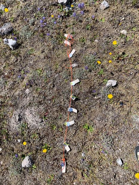
To assess organic matter processing (OMP) within streams across the Pumice Plain, a subset of our research focuses on the use of canvas strips! Canvas strips are a standardized method to accurately examine in-stream ecosystem function. (Tiegs et al. 2013). @ScottTiegs 

Canvas strips with metal ID tags are placed across the streams and riparian zones of the Pumice Plain. This is done to measure how OMP rates vary across environmental differences in early successional streams of Mount St. Helens.

Canvas strips are used to estimate organic matter processing rates in streams and in riparian zones on the Pumice Plain of Mount St. Helens. Photo by Carri LeRoy 

In order to measure OMP, canvas strip assays rely on the loss of tensile strength that corresponds to cellulose degradation while in-stream. Through collaborations with the Olympic College, our team measured this using a giant machine called a tensiometer!

Insects on Willows: Weevils, Beetles, Galling Herbivores

Chrysomelid beetle larvae chew on willow leaves – leaving these patterns of skeletonization behind. Photo by Carri LeRoy 

Willows across the Pumice Plain of Mount St. Helens provide more than just riparian vegetation! They provide shelter, habitat and food to a variety of insects. Insects like Chrysomelid beetle larvae chew their way through willow leaves!

The poplar & willow stem-boring weevil, Cryptorhynchus lapathi, was introduced to Mount St. Helens in 1989. Photo by Carri LeRoy 

Another insect that utilizes the willows is the stem-boring weevil, which is native to Europe but was introduced to Mount St Helens in 1989! The tiny long-nosed guys, show up a lot in our studies as they cause branch death and mortality of willows.    

Galling herbivores like this likely galling midge show variation in activity across the Pumice Plain of Mount St. Helens. Photo by Carri LeRoy

Insects like galling midges have specialized feeding behaviors that require willow leaves as a host. They create new microhabitats for their young via galling. Stay tuned to learn more about the aquatic macroinvertebrates that colonize willow leaves that fall into streams!

New Road Across the Pumice Plain at Mount St. Helens

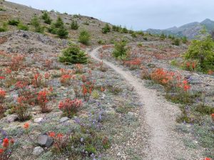
The Truman Trail at Mount St. Helens is beautiful! Help stop the USFS from building a road here! Photo by Carri LeRoy.

Since the eruption of Mount St Helens, the landscape has turned into a living laboratory for ecological research. It’s the most studied volcano in the world. It allows scientists to track how ecosystems and species respond to major disturbances.


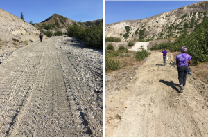
USFS already built this new road to access Spirit Lake in 2018. This was supposed to be the alternative to the Pumice Plain road. Photos by Carri LeRoy

Despite MSH being protected for natural recovery and research, for the past three years the USFS has been trying to build a road across the face of Mount St Helens. The creation of this road would destroy the Truman Trail and alter the ecosystem completely. Learn more about the threatened Truman Trail here: https://www.mshinstitute.org/about_us/rumblings-newsletter/romanos-rumblings-summer-2018.html

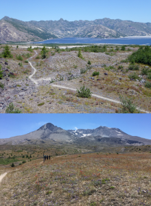
The Truman Trail provides excellent views of both Spirit Lake and the crater of Mount St Helens from the Pumice Plain. Photos by Carri LeRoy. 

Our research on newly developed streams across the Pumice Plain studies would be destroyed. Our lab and many others have been able to fight this off the last two years. To help get our voices heard, we need to actively fight this planned action: https://www.fs.usda.gov/project/?project=57259

You can find out more about the project and read several scientists’ objections to the new proposed road here: https://tdn.com/news/local/forest-service-confirms-proposal-for-spirit-lake-access-road/article_bfa7f34f-4efc-5d80-9588-bda6549a75d7.html

3-year Permit to do Research at Mount St. Helens

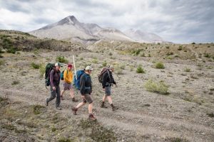
Hiking the 3 miles out to our field sites in the morning. Photo by Shauna Bittle, The Evergreen State College.  

With the Mount St Helens National Volcanic Monument as a protected landscape, our team has a 3-year permit to do research on the Pumice Plain. We hike several miles to reach our study sites, often packing along heavy equipment, but the views of the volcano are worth it!

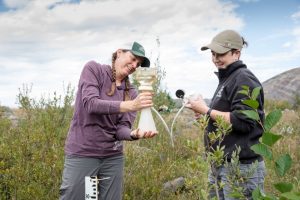
Dr. Carri LeRoy and Evergreen undergraduate Angie Froedin-Morgensen filtering water for chemical analysis. Photo by Shauna Bittle, The Evergreen State College. 

Our research in the newly formed watersheds of the Pumice Plain includes chemical analysis and water quality sampling. These data help us to understand the potential differences in water sources across Pumice Plain watersheds and predict influences on ecosystem function! 

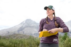
Dr. Carri LeRoy recording field notes with the mountain as a backdrop. Photo by Shauna Bittle, The Evergreen State College.  

The most important thing in field work is proper documentation! What may seem like a tedious task, is a vital component of ensuring our team can continue publishing data about the primary succession of riverine communities at Mount St. Helens! Thanks to Evergreen State College for the great photos!

Animals Colonizing the Pumice Plain of Mount St Helens

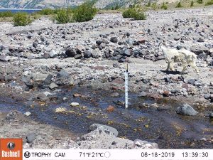
Photo trap intended to measure stream flow captures a mountain goat running along Willow Creek!  

Surely, it’s not only plants on the Pumice Plain! Ecosystems have gradually flourished as more species have filled ecological niches. Ungulates and other mammals have colonized the Pumice Plain.

Our team has documented many animals on accident in our photo traps intended to measure water flow, ephemerality, and seasonality of streams!


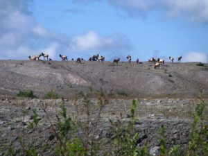
Huge herds of elk call the Pumice Plain home. They are protected from hunting within the National Volcanic Monument. Photo by Carri LeRoy 

While hiking across the Pumice Plain our team has encountered huge herds of elk. They were some of the first large animals to return to MSH after the eruption and they utilize this landscape for grazing the grasses, sedges, and willows of the Pumice Plain!

Sometimes our camera trap stream gauges capture other things! A big fall storm caused massive sediment movement in our streams and also carried other debris downstream. This partial elk carcass got caught up on our stream gauge on Willow Creek. 

Check out the black bear print on Goose Creek on the Pumice Plain of Mount St. Helens in summer 2018! Photo by Carri LeRoy  
An elk leg got wrapped around our stream gauge during a high flow event in Willow Creek! Photo by Carri LeRoy  

The Phenomenal Landscape of the Pumice Plain

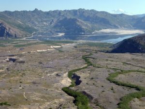
Ribbons of green show riparian vegetation along streams on the Pumice Plain. Photo by Shannon Claeson

Alongside getting to conduct research at Mount St Helens, our team has the opportunity to explore the beautiful landscape of the Pumice Plain.

The Pumice Plain is a 20 km2 region, essentially devoid of life in 1980, but slowly being colonized by a riparian willows and alders. 

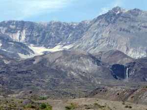
Close-up view of Loowit Falls on the north side of the mountain (right) and a corner of Crater Glacier (left). Photo by Shannon Claeson

Five new watersheds have formed on the Pumice Plain of MSH since 1980, each receiving water from different sources (springs, groundwater, snowmelt, glaciers). Crater Glacier is one of the only glaciers in the lower 48 to be actually growing!

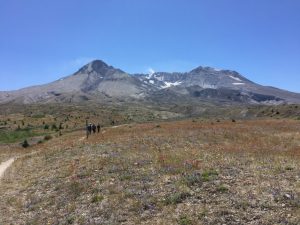
We get to spend hours gazing across fields of wildflowers on the Pumice Plain of Mount St. Helens. Photo by Carri LeRoy 

Landscape scale patterns across watersheds at MSH have allowed us to explore environmental differences across watersheds that don’t vary in age, parent material, slope, or aspect on the sterile and relatively homogeneous Pumice Plain, that 40 years later, is bursting with life!

Newer posts »